Data Points
Transportation Infrastructure in the Region
Interstate Hub
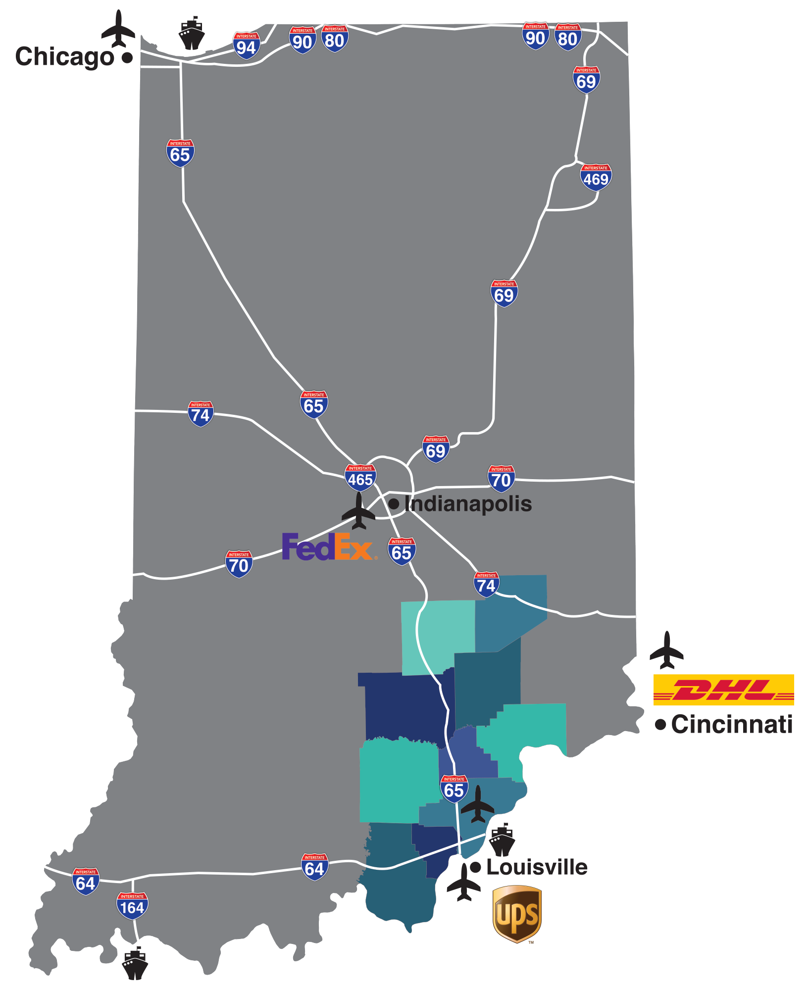
South Central Indiana boasts a strategic location with its intersection of I-65 (north – south) and I-64 (east – west), placing you at the crossroads of the eastern United States. This transportation intersection encompasses our ten counties: Bartholomew, Clark, Decatur, Floyd, Harrison, Jackson, Jefferson, Jennings, Scott, Washington and the River Ridge Commerce Center.
Air, Rail and Water Transportation
You can reach your markets by using our outstanding air, rail and water connections. We are just minutes away from United Parcel Service’s (UPS) major hub located at the Louisville International Airport, where you can ship by midnight and have next day delivery in a majority of the metropolitan areas of the county.
Additionally, just up I-65, Federal Express (FedEx) has a major hub at the Indianapolis International Airport, and just to the east, DHL Airways, Inc. has a domestic hub at the Cincinnati/Northern Kentucky International Airport. Both hubs also provide you with next day delivery.
Three main rail carriers, CSX, Norfolk Southern and Louisville & Indiana Railroad Company, as well as several short lines provide rail service to many of our industrial sites. The Clark Maritime Center, located on the Ohio River, offers full port facilities connecting you to anywhere in the world via the Inland Water System.
Click Image to Enlarge